Route by Postcode step
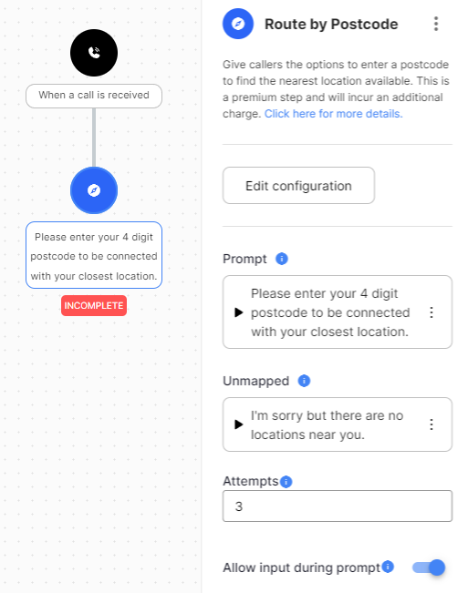
The Route by Postcode step asks the caller to enter a postcode and routes the call to the nearest location. It works with Australian postcodes only.
Route by Postcode is a premium step. Each call that selects a location incurs a charge.
Features
- Add or import locations. Enter store locations by hand or import them from a CSV file.
- Auto-mapping. Map postcodes to one or more locations with rules you set.
- Manual mapping. Override the mapping for specific postcodes, for example to match franchise territories.
- Several locations per postcode. When a postcode maps to more than one location, the caller is asked to choose.
- Recorded or synthesised prompts. Prompts use text-to-speech by default. Use the Text-to-speech mapping feature to replace them with recorded audio.
Configuration
| Field | Description |
|---|---|
| Prompt | Audio that asks the caller to enter a postcode. |
| Invalid | Audio played when the caller enters an invalid postcode. |
| Unmapped | Audio played when the postcode has no location mapped to it. |
| Timeout | Audio played when the caller doesn't enter a postcode in time. |
| Transfer | Audio played when the call is transferred to a location. In text-to-speech, {Location} is replaced with the location's name. |
| Attempt count | How many tries the caller gets. |
| Exit on timeout | Leaves the step through the Incomplete exit on the first timeout. Use it for prompts like "or hold to speak with our team". |
| Timeout seconds | How long the caller has to enter a postcode. |
| Allow input during prompt | Lets the caller enter a postcode before the prompt finishes. |
Postcode viewer
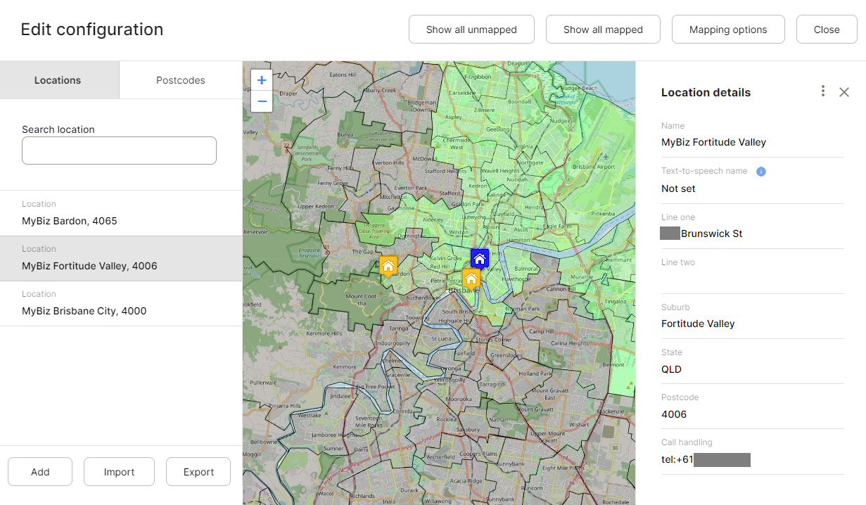
Click Edit configuration on the step form to open the postcode viewer, where you manage locations and mappings.
Locations
Locations are your physical sites. Add them by hand or import them from a CSV file using the template provided.
Mapping options
- Enable auto-mapping maps locations to postcodes according to your mapping rules.
- Map outside locations also maps locations outside a postcode that already contains a location. When it is off, a postcode that contains a location maps to that location only.
Mapping rules
A mapping rule sets a maximum number of locations and a maximum distance from the postcode boundary. For example, map up to 5 locations within 10 km.
Chain rules for flexible results. With the following two rules, postcodes in dense areas get all their nearby locations, and postcodes in sparse areas still get at least one location within 50 km:
- Map up to 9 locations within 5 km.
- Map up to 1 location within 50 km.
Postcodes
Select a postcode in the search box or on the map to see the locations mapped to it.
- For an auto-mapped postcode, click Map manually to change the locations or their order.
- For a manually mapped postcode, add, remove or reorder locations. Click Reset to default to return to auto-mapping.
Exits
| Type | Description |
|---|---|
| Incomplete | The caller didn't make a valid selection within the allowed attempts. |